

Avenue des Volcans : L’Épine Dorsale des Andes Équatoriennes
Randonnez au pied des géants andins : Cotopaxi, le cratère du Quilotoa et le Chimborazo, point le plus proche du Soleil.

Jhayro Ludeña
Lead Naturalist & Head of Expedition Design
The Avenue of the Volcanoes: Crown of the Andes
In 1802, the famed German naturalist and explorer Alexander von Humboldt traversed Ecuador's central highlands and was so awed by the parallel cordilleras flanking over 30 volcanic peaks that he coined the phrase: "The Avenue of the Volcanoes".
Stretching over 325 kilometers from north of Quito down to the southern peaks of Riobamba and Cuenca, this natural amphitheater presents dramatic contrasts—from high-altitude Andean páramo and turquoise crater lakes to subtropical waterfall canyons.
Iconic Landmarks Along the Volcanic Corridor:
1. Cotopaxi National Park & Limpiopungo Lagoon
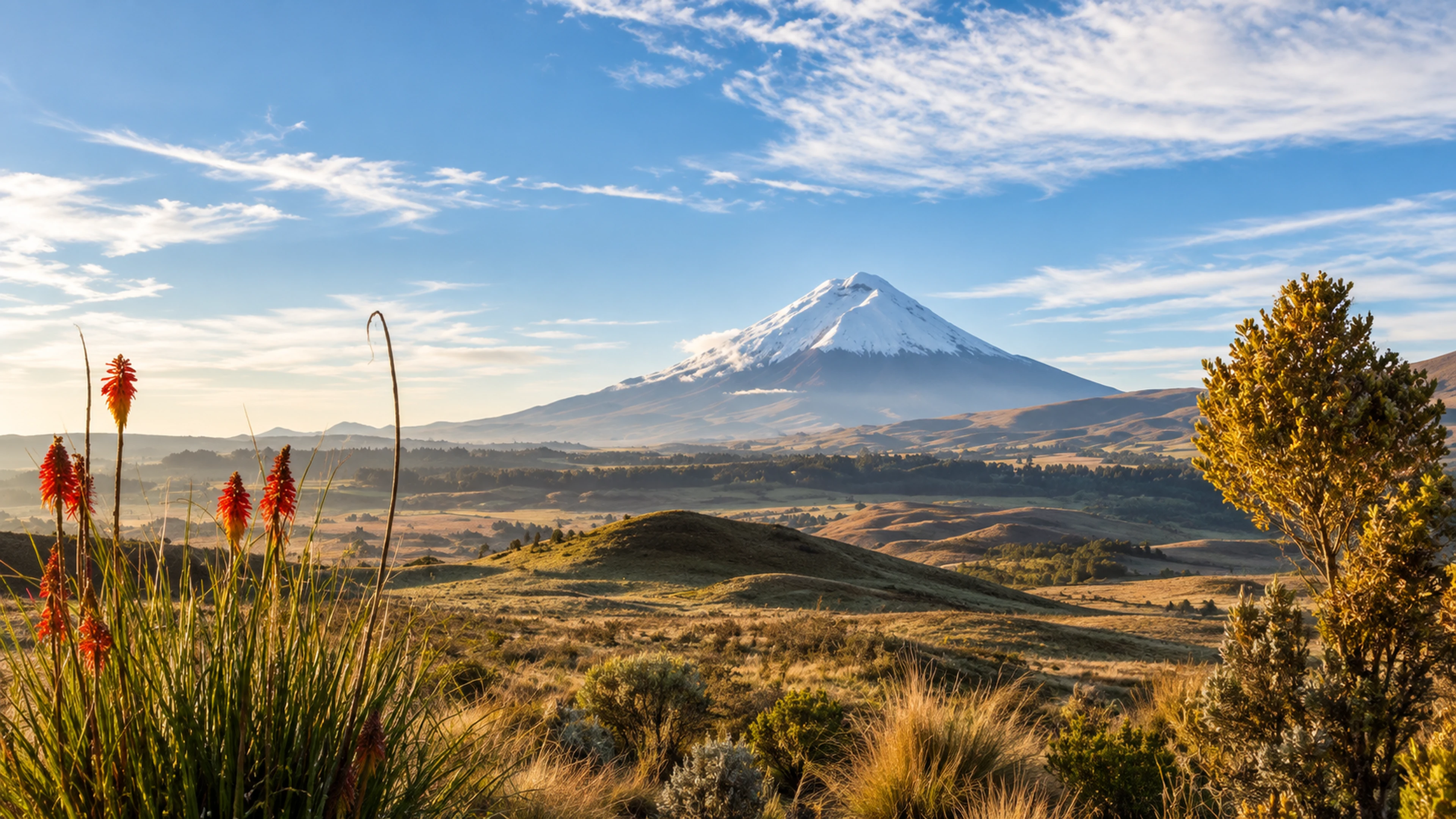
* The Symmetrical Colossus: Rising to 5,897 meters (19,347 ft), Cotopaxi is one of the world's highest active snow-capped stratovolcanoes. * Limpiopungo Lagoon: A tranquil high-altitude glacial lake at 3,850m beneath Cotopaxi’s eastern face, where wild paramo horses graze and migratory Andean gulls, teals, and lapwings gather. * Refugio José Rivas (4,864 m / 15,958 ft): Hike up from the high parking lot on red volcanic pumice scree to touch the edge of Cotopaxi's colossal glaciers.
Cotopaxi Volcano Snow-Capped Peak and High Andean ParamoCotopaxi Volcano Snow-Capped Peak and High Andean Paramo
Découvrez ce site d’exception dans nos itinéraires sur mesure avec guides bilingues et transferts privés.
2. Quilotoa Crater Lake & Toachi River Canyon
* An awe-inspiring 3-kilometer-wide collapsed volcanic caldera containing an emerald-green lake at 3,914 meters (12,841 ft). Dissolved minerals reflect shimmering shades of turquoise, green, and blue depending on solar angle. * Toachi River Canyon: An immense geological fault formed by prehistoric pyroclastic flows, offering breathtaking canyon panoramas on the approach to the crater.
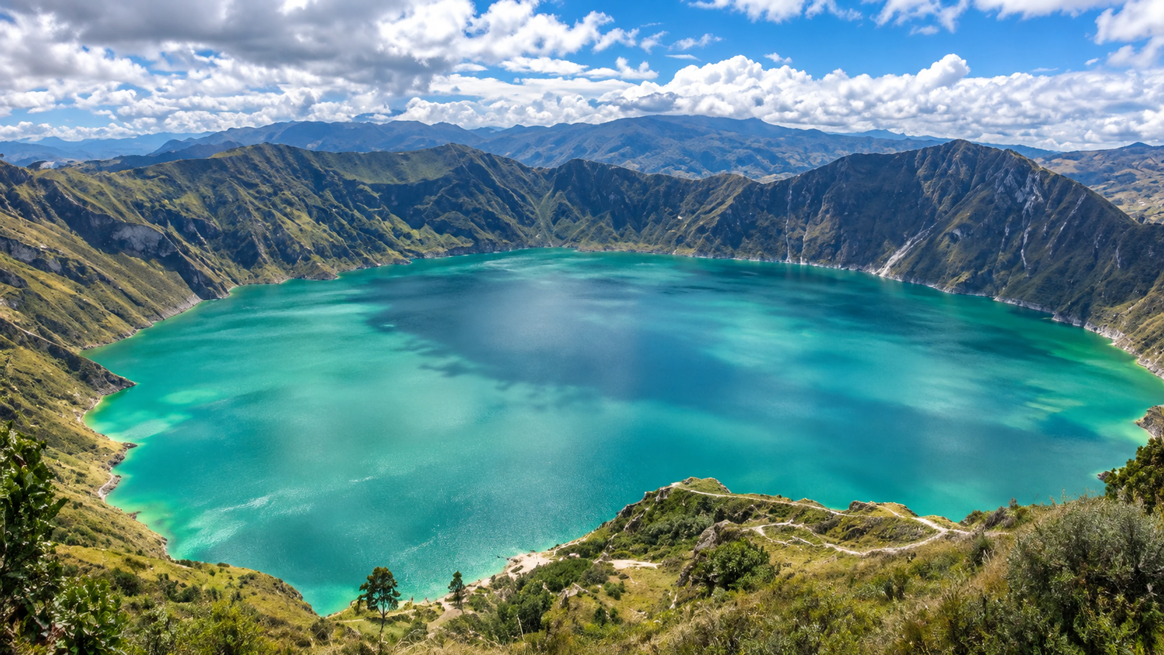 Quilotoa Emerald Volcanic Crater Lake and Canyon Landscapes
Quilotoa Emerald Volcanic Crater Lake and Canyon Landscapes
Découvrez ce site d’exception dans nos itinéraires sur mesure avec guides bilingues et transferts privés.
3. Mount Chimborazo & The Paramo Wildlife Reserve
* The Closest Point on Earth to the Sun: Standing at 6,268 meters (20,564 ft), Chimborazo's ice-clad summit is the furthest point from the Earth's center due to the equatorial bulge. * Chimborazo Fauna Production Reserve: Vast highland grasslands where herds of wild, golden-wooled vicuñas (the wild ancestor of the alpaca) run free alongside Andean foxes and condors.
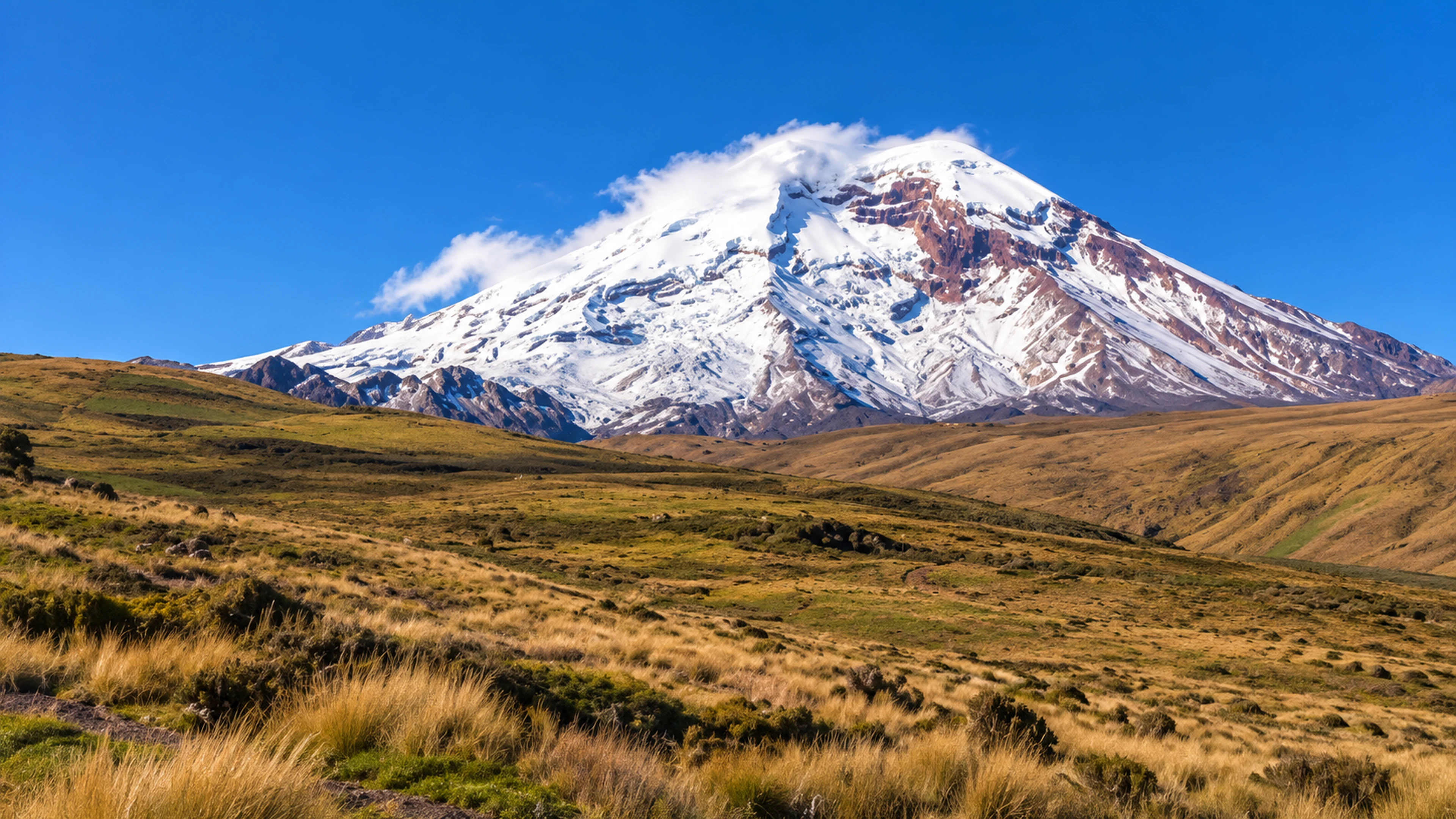 Chimborazo Volcano Paramo Landscape and Vicuñas
Chimborazo Volcano Paramo Landscape and Vicuñas
Découvrez ce site d’exception dans nos itinéraires sur mesure avec guides bilingues et transferts privés.
4. Baños de Agua Santa & Pailón del Diablo
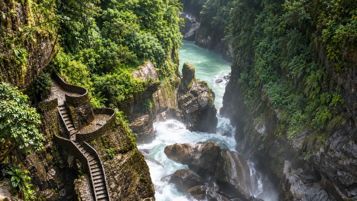
* Where the Andes plummet into the lush Amazonian cloud forest. Walk over suspension bridges to witness El Pailón del Diablo (The Devil's Cauldron), one of South America's most powerful and thunderous waterfalls.
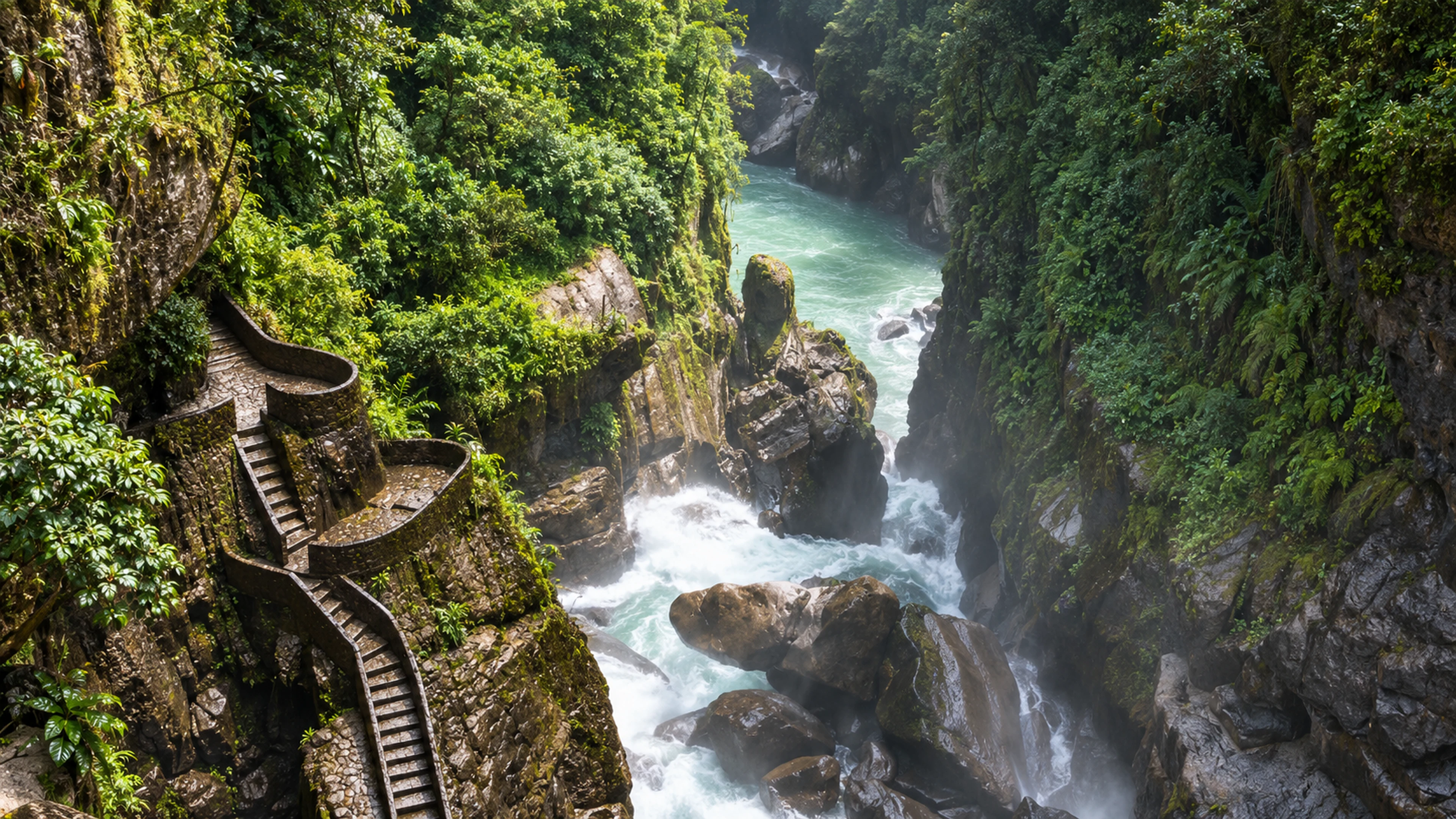 Pailon del Diablo Waterfall in Banos Cloud Forest
Pailon del Diablo Waterfall in Banos Cloud Forest
Découvrez ce site d’exception dans nos itinéraires sur mesure avec guides bilingues et transferts privés.
🧭 High-Altitude Naturalist Pro-Tips: * **Layering System ("The Onion Principle"):** Andean mountain weather changes in minutes. Wear a breathable thermal base layer, an insulating fleece mid-layer, and a waterproof/windproof outer shell. * **Extreme UV Protection:** UV levels at 4,000+ meters on the equator are the highest on Earth. Pack category 3 or 4 UV sunglasses, wide-brim hats, and mineral SPF 50+ sunscreen. * **Hydration:** High altitude accelerates dehydration. Drink at least 2.5 to 3 liters of water daily, avoiding alcohol or carbonated beverages before hikes. * **⚡ 24-Hour Express Departures:** Want to trek Cotopaxi or Quilotoa tomorrow? Vermilion Routes coordinates private vehicles, mountain guides, and national park authorizations on 24-hour notice.
Questions Fréquemment Posées
Expert travel answers & verified destination planning insights
Q1.¿Cómo prevenir el mal de altura (soroche) en los volcanes andinos?
Aclimatarse en Quito durante 24 a 48 horas antes de ascender a más de 3.500 msnm. Beber de 2.5 a 3 litros de agua diarios, ingerir carbohidratos y comidas ligeras, evitar alcohol y tomar infusiones de mate de coca o sunfo. Nuestros vehículos privados cuentan con botiquín y oxígeno de emergencia para total tranquilidad.
Q2.¿Es posible descender al fondo del cráter del Quilotoa y volver a subir?
Sí. El descenso desde el mirador (3.914 msnm) hasta la orilla del lago verde esmeralda toma de 35 a 45 minutos. El ascenso de regreso es empinado (400 metros de desnivel a gran altitud) y toma de 1.5 a 2 horas a pie. Para quienes prefieran no fatigarse, la comunidad indígena local ofrece servicio de mulas o caballos para subir cómodamente.
Q3.¿Por qué el volcán Chimborazo es el punto más cercano al Sol y no el Everest?
Debido al ensanchamiento ecuatorial de la Tierra: el planeta es más ancho en el ecuador que en los polos. Aunque el Everest tiene mayor altitud sobre el nivel del mar (8.848 m), el Chimborazo (6.268 m) se ubica prácticamente en la línea equinoccial. Medido desde el centro mismo del planeta, la cumbre del Chimborazo está 2.072 metros más alejada del centro terrestre que el Everest, convirtiéndose en el punto más cercano al Sol en toda la Tierra.
Explorez 300+ Photographies de Terrain
Découvrez des clichés haute résolution de faune endémique et paysages volcaniques.

Jhayro Ludeña
Guide Naturaliste Principal & Directeur des Itinéraires
Vermilion Routes · Quito & Galápagos, Équateur
“Natif des Andes équatoriennes avec plus de 12 ans d’expérience dans la conduite d’expéditions privées aux Galápagos, en Amazonie et sur l’Avenue des Volcans. Spécialiste de la faune endémique et de la logistique sur mesure, certifié par le Ministère du Tourisme de l’Équateur.”
Vivez l'Expérience : Circuits à Volcans des Andes
Transformez l’inspiration en réalité. Réservez des itinéraires sur mesure avec guides naturalistes certifiés et conciergerie VIP 24/7.
Des Andes à l'Amazonie: Volcans et Rivières
8-day overland journey connecting Quito Historic Center, Equator Line, Papallacta thermal springs, Tena Amazon lodge with motorized canoe, Yanacocha rescue biopark, Baños waterfalls & Pailón del Diablo (Devil's Cauldron), and Quilotoa Crater Lake.
Rencontre aux Galápagos: 6 Jours Merveilleux (Transferts UIO Inclus)
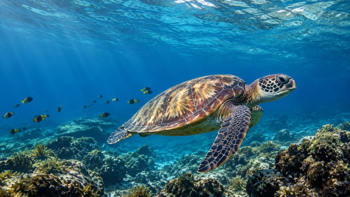
Circuit complet de 6 jours comprenant transferts privés à Quito, hauts plateaux de Santa Cruz, tortues géantes au Rancho Primicias, excursion d'une journée à l'île Isabela avec snorkeling à Tintoreras et flamants roses, et Las Grietas.
Expédition Galápagos: 7 Jours d'Aventure (Transferts UIO Inclus)
Voyage inoubliable de 7 jours reliant les transferts privés à Quito, les hauts plateaux de Santa Cruz, une nuit sur l'île Isabela avec Tintoreras et flamants roses, Las Grietas et une excursion navigable d'une journée en yacht vers Santa Fe ou Pinzón.
Vous préférez un voyage 100% sur mesure à Volcans des Andes ?
Indiquez-nous vos souhaits et nos concepteurs élaboreront votre proposition exclusive en moins de 24h.
Guide Ultime des Bagages pour l’Équateur et les Galápagos 2026
Sélectionné par nos guides naturalistes. Envoyé directement dans votre boîte de réception.
Zéro spam. Désabonnement possible à tout moment.